


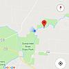
I'd never been to this spring before but it had been on my list of places to find for several years. I parked at the public boat ramp near the "Big Oak trail" portion of the Florida trail on the west side of the Suwanee river, approximately 2 miles north of the Suwanee River State Park boat ramp. I took a little hike through the woods via the Florida trail. Not far along, I passed 5 hole spring area and and then not long after that I was able to catch site of Line Eater Spring on the opposing bank of the river. From 50+ yards away I could see a strong boil and clear water in the basin... time to dive!
I don't currently own a "river appropriate boat" although one of the local residents I spoke to on my hike offered me a canoe with no paddles... I decided I would stick to my original plan. I'll spare the details but it involved a snorkel and a scooter. At the spring pool basin there was strong flow and fairly clear water with a green tint. Mainline was intact about 25' inside the cavern area. Viz was poor at 15' with chunky debris flowing through the water. since I learned there are other sinks 3000+ upstream in this system, i had images of some guy dumping his lawn clippings and yard debris in the hole, as that's kind of what the crap flowing past me looked like. The line was buried in several spots but was easily dug out and intact. The most challenging/dangerous aspect of this dive were the multiple lines in the system. It was obvious that the original line was in there but also a couple additional mainlines had been added likely due to the various floods over the years burying and unburying the different lines. With the low viz and multiple lines it was important to ensure you were consistently following the correct continuous guideline because often you would be following your line and the other lines would come in and out of view due to the viz. You could easily start following the wrong line because of this. Based on the map I found on CaveAtlas.com I would guess I turned the dive somewhere around the 1200-1400' area in the area called the "pit" with a max depth of 64'. the line I was following (seemed to be the newer of the 3 lines in there) abruptly ended in a pile of silt and had a loop tied in it. I could see another line ahead in the distance but at that point was worried I had deviated onto a side loop and decided to back track to make sure. Upon turning the viz quickly dropped to 5-6' due to all the crap getting knocked off the ceiling from my bubbles.
This cave's composition reminded me of little river... smooth limestone walls, ceilings and some floors with a brownish tint. There are some very neat formations similar to little river, especially once you drop down into the pit area. The floors are sandy/silt mix in most areas but there were spots of river rock and other areas that had smooth limestone floors.
Back in the cavern at approx. 55 min and still having ample gas supply I decided to make another run up the mainline and go a bit slower, zig zagging back and fourth up the passage so I could get a better visual of the walls and ceilings. with the crappy viz you could never see both walls at the same time nor the ceiling and the floor at the same time, so it left a little to the imagination to fill in the blanks. I turned this dive just into the "pit" and had a nice drift back out to the spring pool.
total dive time 91 minutes, max depth 64', viz 15' (average).
I would guess as the rainy season comes to an end and the river level drops a bit more, the flow will pick up but the viz should improve.
Note: 5 hole spring had nice clear water dumping into the river but I did not get out to take a closer look. I also took a little hike at Suwanee River State Park and saw that Little Gem Spring was PUMPING high volumes of clear water into the river. It is my understanding both of those sites are permit only.
Welcome to the Cave Diver's Forum.
 Reply With Quote


Bookmarks